Αριθμός μηνυμάτων : 8056 Registration date : 10/07/2008
Θέμα: Blue Marble 2000 20.10.08 18:42
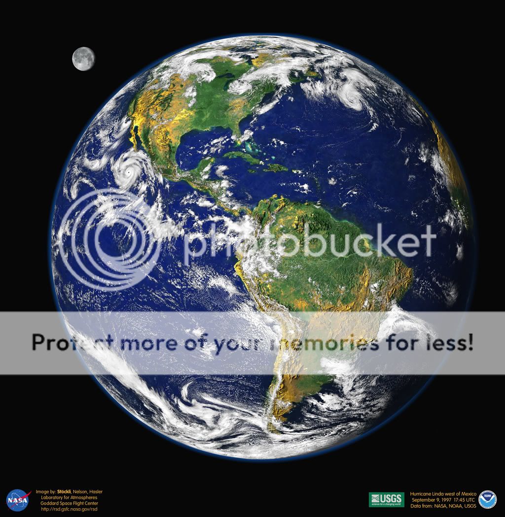
Blue Marble 2000
This digital portrait of our planet is reminiscent of the Apollo-era pictures of the "big blue marble" Earth from space.
To create it, researchers at Goddard Space Flight Center's Laboratory for Atmospheres combined data from a Geostationary Operational Environmental Satellite (GOES), the Sea-viewing Wide Field-of-view Sensor (SeaWiFS), and the Polar Orbiting Environmental Satellites (POES) with a USGS elevation model of Earth's topography.
Stunningly detailed, the planet's western hemisphere is cast so that heavy vegetation is green and sparse vegetation is yellow, while the heights of mountains and depths of valleys have been exaggerated by 50 times to make vertical relief visible.
Hurricane Linda is the dramatic storm off North America's west coast. And what about the Moon? The lunar image was reconstructed from GOES data and artistically rescaled for this visualization.
Credit: R. Stockli, A. Nelson, F. Hasler, NASA/ GSFC/ NOAA/ USGS
Blue Marble 2000
Σελίδα 1 από 1
Παρόμοια θέματα
Παρόμοια θέματα
Δικαιώματα σας στην κατηγορία αυτή
Δεν μπορείτε να απαντήσετε στα Θέματα αυτής της Δ.Συζήτησης